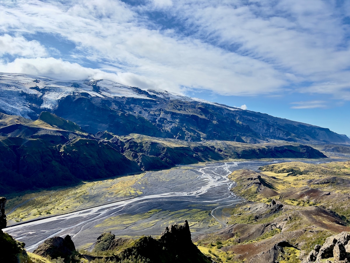
Þórsmörk (Thor’s Forest) is a glacial valley carved out by three icecaps - Eyjafjallajökull to the south, Mýrdalsjökull to the east, and Tindfjallajökull to the north. The valley floor is covered in birch woodland and willow scrub, which gives Þórsmörk an unusually sheltered and green character compared to most Icelandic highland terrain. Three mountain huts - Húsadalur (Volcano Huts), Básar (Ferðafélag Íslands), and Langidalur - give visitors accommodation options ranging from camping to breakfast-included guesthouse stays.
Þórsmörk sits at the southern end of the Laugavegur Trail and the northern start of the Fimmvörðuháls route to Skógafoss. It draws hikers completing multi-day routes, day trippers from Reykjavík, and 4WD vehicle owners who drive the F249 from the south.
Valahnúkur Viewpoint
The single most rewarding hike from Húsadalur. The trail climbs from the hut area to the Valahnúkur ridge, gaining around 200–250m in approximately 1–1.5 hours. The summit viewpoint looks out across all three surrounding glaciers, the entire Þórsmörk valley, and on clear days toward Hekla and the southern plains. Return trip 2–3 hours including time at the top. No entry fee; trail is marked. This is the hike to prioritise if you have limited time in the valley.
Tindfjallajökull Glacier Views
Tindfjallajökull is the smallest of the three glaciers surrounding Þórsmörk and can be viewed directly from the Básar and Húsadalur hut areas. There is no guided glacier walk on Tindfjallajökull, but the view from the huts - particularly in morning light - is excellent. Free to view.
Fimmvörðuháls Day Walk
One of the most challenging day walks in Iceland, starting from Þórsmörk (Básar hut) and ending at Skógafoss. The route is 25km with approximately 1,200m of elevation gain, taking 8–10 hours for a fit walker. The path crosses the high pass between Eyjafjallajökull and Mýrdalsjökull, passing by two new craters created during the 2010 Eyjafjallajökull eruption. In the opposite direction (Skógafoss to Þórsmörk), it’s equally challenging. No entry fee; the trail is well-marked. Require good fitness, proper hiking gear, and a weather window - the pass is exposed and conditions change quickly.
Laugavegur Trail - End Point
Þórsmörk marks the southern end of the Laugavegur Trail, 55km from Landmannalaugar. Hikers completing the trail typically arrive at either Húsadalur or Básar huts. From Þórsmörk, the bus back toward Seljalandsfoss and Reykjavík departs from outside Húsadalur - check the current Reykjavík Excursions timetable at re.is before you start the trail, as the last buses don’t wait.
River Walk: Básar to Húsadalur
A pleasant valley-floor walk linking the two main hut areas, approximately 2.5km each way through birch woodland and along river banks. Short, relatively flat, and a good option for a morning stretch if you’ve arrived the night before. Free; no marked trail required - follow the valley bottom.
Waterfall Walks Near the Huts
Short, well-marked waterfall trails branch out from both Húsadalur and Básar. These take 30–90 minutes and offer close-up views of the streams that run off the surrounding glaciers and ridges. No entry fee.
Getting to Þórsmörk
By bus: Reykjavík Excursions (re.is) runs scheduled services from Seljalandsfoss to Þórsmörk (the Þórsmörk bus also stops at Seljalandsfoss and sometimes at Skógar). Return tickets approximately ISK 7,000 as of 2026. Buses run June through September.
By 4WD: Take Route 249 from Route 1 near Seljalandsfoss. The Krossá river crossing is unavoidable - 60–80cm deep in normal summer conditions, occasionally higher after heavy rain. Only attempt in a proper high-clearance 4WD. Do not attempt this crossing in a standard rental car under any circumstances.
Browse Iceland tours - day trips, activity bookings, and multi-day packages across the country in one place.
Compare car hire in Iceland - a 4WD or campervan gives the flexibility to explore at your own pace.
Accommodation in Þórsmörk
Search hotels in Þórsmörk on Booking.com
Húsadalur (Volcano Huts) - The largest accommodation option in Þórsmörk, with guesthouse-standard rooms, hot showers, and a restaurant. Doubles with breakfast from approximately ISK 12,000 per person as of 2026. Booking at volcanohuts.com.
Básar (Ferðafélag Íslands) - The traditional mountain hut at Básar, operated by the Iceland Touring Association. Sleeping bag spaces in dormitory accommodation. Approximately ISK 7,500 per person per night as of 2026. Camping alongside the hut approximately ISK 2,500. Book through fi.is.
Both huts require advance booking for July and August. Walk-in spaces exist but are not guaranteed in peak season. For those starting or finishing the Laugavegur Trail, see our Landmannalaugar guide for the northern end of the route.