Þórsmörk: Laugavegur Trail, Glaciers & Valley Hikes
Guide to Þórsmörk - the valley between three glaciers, the end of the Laugavegur trail, Valahnúkur hike, and highland bus access.
Guides for Þórsmörk
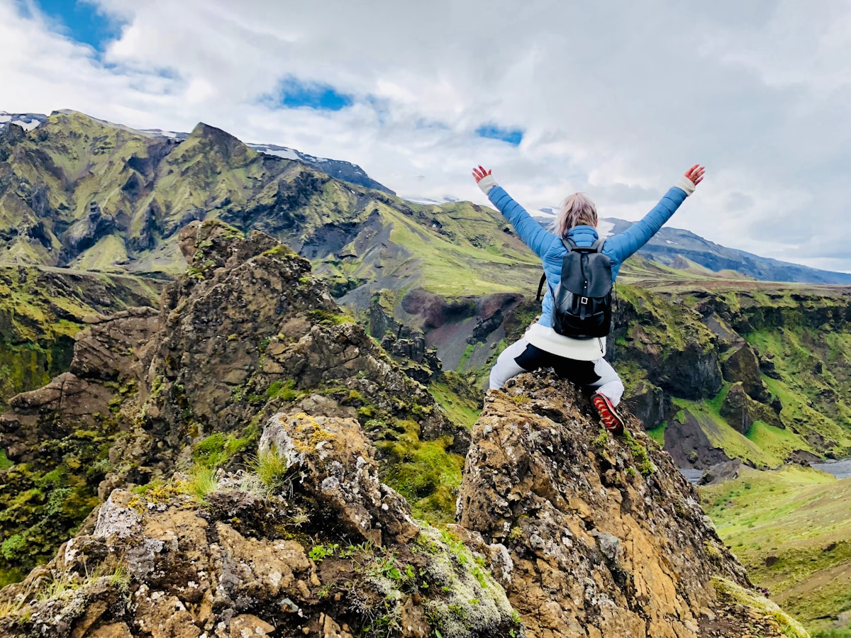
Þórsmörk (‘Thor’s Forest’) is a glacially carved valley system at approximately 200m altitude in South Iceland, enclosed on three sides by Eyjafjallajökull, Mýrdalsjökull, and Tindfjallajökull glaciers. Despite being only 150km from Reykjavík, it feels genuinely remote - no road reaches it without multiple river crossings, and the surrounding glaciers create their own microclimate. It’s the southern endpoint of the Laugavegur trail and the northern end of the Fimmvörðuháls trail to Skógafoss, making it one of Iceland’s main hiking hubs.
Getting There
By Highland Bus (recommended for most visitors): Several operators run scheduled services:
- Reykjavík Excursions (re.is) - from BSÍ terminal, seasonal service in summer. Approximately ISK 7,900–9,500 one way.
- Trex (trex.is) - direct Reykjavík to Þórsmörk. ISK 7,900 one way approximately.
- Strætó route 11 - from Hvolsvöllur (which is served by route 51 from Reykjavík). Check straeto.is.
By 4WD: Route F249 from Route 1 near Hvolsvöllur. Multiple river crossings required; not passable in standard 2WD cars or unmodified 4WDs with low clearance. Allow 1.5–2 hours from Route 1.
Valahnúkur
The most accessible viewpoint - a 466m peak above the hut area. A marked trail (approximately 2–3 hours return) with switchbacks leads to the summit. Views from the top encompass all three surrounding glaciers, the valley floor, and on clear days the South Coast. This is the hike to prioritise if you have only a few hours.
Þórsmörk Valley Trails
The valley itself has multiple trails of varying length through birch woodland, across glacial rivers, and up to ridgelines overlooking the glaciers. Trail maps are available from the hut wardens. Recommended:
- Þórsmörk circuit (8–10km, 3–4 hours) - A woodland and ridge trail through the main valley area.
- Goðaland (area east of main valley) - More dramatic terrain with exposed ridges and views of Eyjafjallajökull. Access involves some scrambling.
Fimmvörðuháls Trail
The 25km trail over the mountain pass to Skógafoss on the South Coast. One of Iceland’s best day hikes but long and serious - good weather and early start essential. The pass section (above 1,000m) can have snow even in July. The trail passes two craters formed during Eyjafjallajökull’s 2010 eruption. Mountain huts at Baldvinsskáli (600m) and Fimmvörðuskálar (1,100m, at the pass) allow splitting into 2 days.
Laugavegur Trail
Þórsmörk is the southern endpoint of the 55km Laugavegur trail from Landmannalaugar. Hikers typically spend their final night at Langidalur or Húsadalur huts in Þórsmörk before departing by bus the following morning.
Where to Stay
Search hotels in Þórsmörk on Booking.com
For mountain huts, camping, and highland sleeping bag accommodation in Þórsmörk, see our Where to Stay in Þórsmörk guide. Langidalur (FÍ) and Húsadalur (Volcano Huts) are the only options - both book out months in advance for July and August.
Practical Notes
- Mobile signal in Þórsmörk is limited - download maps before arrival
- Weather changes rapidly - pack full waterproofs even on sunny days
- River levels can rise quickly after rain - if self-driving, never cross flooded rivers; wait or turn back
- Hiking boots with ankle support are necessary - the terrain is rough and wet
- Bears: there are none. Wolves: none either. Arctic foxes may be seen.
Tindfjöll Mountains
The Tindfjallajökull glacier and the surrounding Tindfjöll mountain range form the western wall of Þórsmörk. Several routes climb into the Tindfjöll from the valley - these are more serious hikes than Valahnúkur and require experience in highland terrain. The ridge between Tindfjallajökull and the Goðaland area offers exposed but spectacular walking.
Stakkholtsgjá Canyon
A narrow canyon approximately 2km from the Langidalur hut area, accessible on foot. The trail leads into a slot canyon with moss-covered walls rising steeply on both sides. In wet weather, a small waterfall appears at the canyon’s end. The walk takes approximately 45 minutes each way. The path crosses a shallow stream - waterproof boots are essential. Free.
Costs and Budgeting
Day trip from Reykjavík: Highland Bus return approximately ISK 15,800–19,000 per person. Add approximately ISK 2,500 for lunch at the Volcano Huts café. Total approximately ISK 18,000–21,500 per person for a day trip.
Overnight at Langidalur Hut: ISK 8,900 per person (sleeping bag space). Bring your own food for the hut kitchen, or buy meals at the Volcano Huts café (soup approximately ISK 2,200, mains approximately ISK 3,000–4,500).
Camping: ISK 2,200 per person per night at Húsadalur. The cheapest option but requires carrying your own tent and sleeping gear.
Laugavegur trail (4 days): Hut accommodation approximately ISK 8,900 per night x 3–4 nights = ISK 26,700–35,600 for huts alone. Add bus transport at both ends (approximately ISK 8,900 each way) and food. Total budget: approximately ISK 55,000–75,000 per person for the full trail.
Season and Timing
Þórsmörk is accessible from approximately mid-June to mid-September. The highland buses begin running when the rivers are passable - this varies by year. July and August are the busiest months; mid-June and September offer quieter conditions but colder temperatures and potentially higher river levels. The huts book out months in advance for July and August - plan early.
The 2010 Eyjafjallajökull eruption (which disrupted European air traffic) occurred immediately above Þórsmörk. The valley itself was largely unaffected, but the eruption created two new craters visible from the Fimmvörðuháls trail - Magni and Móði, named after Thor’s sons.
Book Laugavegur trek options - guided and self-guided packages with luggage transfers available.
Pre-book Keflavík airport transfers - Flybus and private options for the 45-minute route to Reykjavík.
Compare car hire in Iceland - a 4WD or campervan gives the flexibility to explore at your own pace.
Explore Þórsmörk Further
- Things to Do in Þórsmörk - Day hikes, canyon trails, the Stakkholtsgjá slot canyon, and the Laugavegur start point
- Landmannalaugar vs Þórsmörk - Which highland destination to choose, and why doing both via the Laugavegur is the best option
- Fimmvörðuháls trail - The 25km trail from Þórsmörk to Skógafoss: one of Iceland’s best day hikes
- Laugavegur trail - The iconic 4-day trail ending at Þórsmörk, starting at Landmannalaugar
- Iceland F-roads guide - F249 into Þórsmörk: river crossings, 4WD requirements, and when to go
Book an experience
Top experiences in Þórsmörk
Explore the best tours and activities in Þórsmörk , with instant confirmation and free cancellation on most bookings.