Kirkjubæjarklaustur: Lava, Waterfalls & South Iceland
Guide to Kirkjubæjarklaustur - Fjaðrárgljúfur canyon, Kirkjugólf basalt floor, the 1783 Laki eruption story, and Ring Road driving east.
Guides for Kirkjubæjarklaustur
Kirkjubæjarklaustur (universally shortened to ‘Klaustur’ by anyone who’s tried to say it twice) is a small settlement of approximately 150 people in the eastern South Iceland lowlands, halfway between Vík and Höfn. It sits in the shadow of the Vatnajökull ice cap to the north and between the Skaftá and Hverfisfljót rivers. Its relative isolation and position on the Ring Road make it a natural overnight stop - and it has more geological and historical significance than its size suggests.
Getting There
By car: 75km east of Vík on Route 1. Allow 1 hour. From Höfn it’s approximately 135km - 1.5–2 hours.
By bus: Strætó route 51 connects Reykjavík to Höfn via Klaustur. The journey from Reykjavík takes approximately 5 hours. Infrequent service.
Fjaðrárgljúfur Canyon
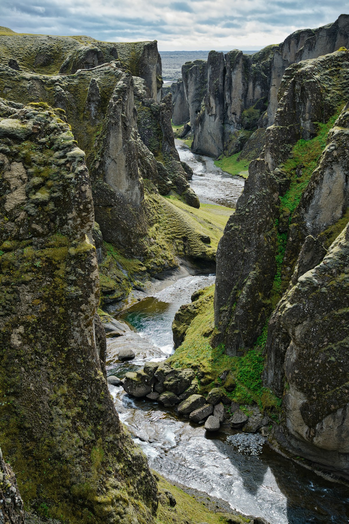
The area’s standout attraction, approximately 7km north of the village on Route 206. A deep, sinuous canyon cut by the Fjaðrá river through palagonite rock formed during sub-glacial volcanic eruptions. The canyon is 100m deep and approximately 2km long; a marked walking trail runs along the eastern rim with multiple viewpoints. Free entry. Allow 30–45 minutes for the rim walk. Accessible year-round but the path can be slippery in winter.
Kirkjugólf
A flat basalt floor exposed beside the road through the village - the tops of hundreds of hexagonal basalt columns, naturally jointed and worn flat, forming what looks like a paved floor. Approximately 80 square metres in area. Early settlers believed it was a church floor from pre-Settlement times; the name means ‘Church Floor’. Free. Five minutes to view.
Laki Fissure (Lakagígar)
One of Iceland’s most catastrophic volcanic events occurred here. In 1783–84, the Laki fissure erupted continuously for 8 months, releasing an estimated 14km³ of lava and massive amounts of sulphur dioxide. The resulting ‘Haze Famine’ killed approximately 25% of Iceland’s population, poisoned livestock across the country, and sent sulphurous haze across Europe and North America. In France it contributed to the conditions preceding the Revolution.
Laki is accessible from Klaustur via a highland F-road (F206) open approximately June–September. A 4WD is required. The fissure row contains 130 craters. The drive takes approximately 1.5–2 hours from Klaustur one way. No guided tour is needed but check road.is before heading out.
Systrafoss Waterfall
A double waterfall immediately above Klaustur, visible from the village. A short walk (approximately 20 minutes return) through birch woodland leads to the base. Free.
Núpstaður
A cluster of old turf farm buildings at the foot of the Núpsstaðarháls cliff, approximately 25km east of Klaustur. One of Iceland’s best-preserved traditional farm complexes - several of the buildings date to the 17th and 18th centuries. The small church (Núpstaðakirkja) is particularly well preserved. Free to view from outside.
Where to Stay
For the full picture on accommodation in and around Kirkjubæjarklaustur, see our Where to Stay in Klaustur guide. Beds here are very limited - in peak summer (July), the hotel and guesthouses often fill weeks in advance.
Where to Eat
Hótel Kirkjubæjarklaustur Restaurant - The only sit-down restaurant for many kilometres. Lamb, fish, and burgers. Mains approximately ISK 2,800–4,500. Reliable quality given the limited competition.
Systrakaffi - Café and grill attached to the petrol station in the village. Soup, sandwiches, and hot food. The practical option. Soup and bread approximately ISK 2,200.
Klausturkaffi - A smaller café option near the church. Coffee, cakes, and light meals. Open seasonally (summer months). Coffee and cake from approximately ISK 1,200.
Swimming Pool
Kirkjubæjarklaustur Swimming Pool - A small heated outdoor pool with a hot tub. Open year-round (reduced hours in winter). Entry approximately ISK 1,000 adult as of 2026. After a day driving the Ring Road or hiking Fjaðrárgljúfur, the hot tub is worth the stop.
The Fire Sermon (Eldmessa)
On 20 July 1783, as the Laki eruption threatened to destroy everything, the local pastor Jón Steingrímsson gave what became known as the “Fire Sermon” in the village church. According to local tradition, the lava flow stopped advancing during the service. The event is commemorated with an annual ceremony in late July. The church (Kirkjubæjarkirkja) still stands and is open to visitors - a modest white building with a plaque explaining the story. Free entry.
Dverghamrar (Dwarf Cliffs)
A formation of regular basalt columns approximately 10km west of Klaustur on Route 1, directly beside the road. The columns are smaller and more delicate than most Icelandic basalt formations, which is how they earned their name - local legend attributed them to dwarves. A 5-minute walk from the pull-off. Free. A brief but worthwhile stop when passing.
Practical Information
Fuel and supplies: The N1 petrol station in the village centre is the only fuel stop between Vík (75km west) and Höfn (135km east). Fill up here. The station has a small convenience shop for basic supplies, but for proper grocery shopping the nearest supermarkets are in Vík or Selfoss.
Road conditions east of Klaustur: The section of Route 1 between Klaustur and Höfn crosses several sandur - flat glacial outwash plains. These are exposed to wind and sand in bad weather. In winter, this section can close for wind. Always check road.is before heading east.
Accommodation booking: Klaustur has very limited beds - in peak summer (July), the hotel and guesthouses are often fully booked weeks in advance. If visiting during peak season, book accommodation before you leave Reykjavík rather than hoping for availability on arrival.
Browse Iceland tours - day trips, activity bookings, and multi-day packages across the country in one place.
Pre-book Keflavík airport transfers - Flybus and private options for the 45-minute route to Reykjavík.
Compare car hire in Iceland - a 4WD or campervan gives the flexibility to explore at your own pace.
Explore Kirkjubæjarklaustur Further
- Things to Do near Kirkjubæjarklaustur - Fjaðrárgljúfur canyon, Lakagígar craters, Dverghamrar, and the Laki volcanic field
- South Coast drive - Kirkjubæjarklaustur sits midway on the South Coast route between Vík and Jökulsárlón
- Skaftafell and Vatnajökull National Park - 50km east: the next major stop with glacier hikes and Svartifoss
- Vík travel guide - 75km west: the other main South Coast overnight base
- Ice caves in Iceland - Klaustur is a practical overnight base for Vatnajökull ice cave tours in winter
Book an experience
Top experiences in Kirkjubæjarklaustur
Explore the best tours and activities in Kirkjubæjarklaustur , with instant confirmation and free cancellation on most bookings.