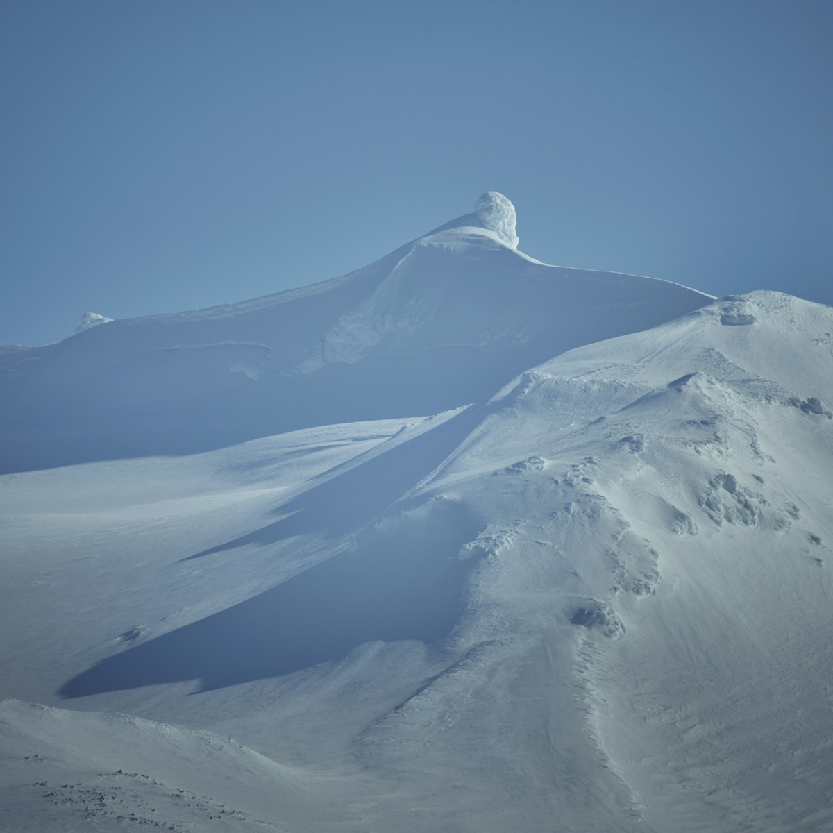
Snæfellsnes Peninsula stretches 90km west from the main Icelandic landmass into the North Atlantic, capped by the Snæfellsjökull glacier that Jules Verne used as the entrance to his journey to the centre of the Earth. The peninsula has a concentration of accessible, visually distinct sites that makes it one of the best single-day drives in Iceland - a mini-Iceland with black beaches, sea cliffs, ancient lava fields, a glacier, and a mountain that looks like it was designed to be photographed. This guide covers the main day trip destinations, all reachable on paved or well-maintained roads.
Kirkjufell and Kirkjufellfoss
Location: West of Grundarfjörður on Route 54 - approximately 50km west of Stykkishólmur, 40 minutes by car from the eastern end of the peninsula
Kirkjufell is Iceland’s most photographed mountain: a steep, symmetrical peak rising 463m from the peninsula’s north coast, with the braided Kirkjufellfoss waterfall in the foreground. The combination of mountain, water, and (in season) northern lights or lupine fields has made it one of the most recognisable images in Icelandic travel photography.
The viewpoint with Kirkjufellfoss in the foreground is a 5-minute walk from the car park on Route 54, signposted from the road. Photography is best in the morning when light hits the east face, or in the blue hour after sunset. Entry to the viewpoint area is free.
Climbing Kirkjufell: The summit route is steep, exposed, and requires a rope in places - it is not a casual hike. Two guided ascent operators run tours from the base car park; cost approximately ISK 12,000–16,000 per person as of 2026, with equipment provided. Unguided climbing is technically possible but has resulted in serious accidents. Do not attempt without experience and appropriate gear.
Arnarstapi Sea Cliffs and Coastal Walk
Location: South coast of the peninsula on Route 574 - approximately 30km from Stykkishólmur via Route 54 and 574 (45 minutes)
Arnarstapi is a small fishing village at the foot of the Snæfellsjökull glacier with dramatic basalt sea cliff formations directly accessible from the village. The coastal walk between Arnarstapi and Hellnar (approximately 2.5km one way, 45 minutes) passes through a landscape of eroded lava arches, sea caves, and nesting seabird colonies - Arctic terns, fulmars, and kittiwakes throughout summer.
The Gatklettur basalt arch (a natural rock arch over the sea, accessible via a short path from Arnarstapi) is one of the most distinctive rock formations on the peninsula. The walk to the arch from the village takes approximately 10 minutes.
Entry to the coastal area is free. Arnarstapi has a small café and a glacier tour operator at the village. Parking available at both Arnarstapi and Hellnar.
Snæfellsjökull Glacier and National Park
Location: Tip of the peninsula - approximately 25km from Arnarstapi on Route 574
Snæfellsjökull is a glacier-capped stratovolcano last confirmed active in 1750, now dormant but geothermally warm beneath the ice. At 1,446m it is visible from Reykjavík on a clear day - a distance of approximately 120km. The national park surrounding it covers the entire tip of the peninsula.
Without a guided tour: Drive Route 574 around the glacier’s southern and western perimeter. Stop at Djúpalónssandur beach (see below), walk the marked path near the Snæfellsjökull visitor centre (at Malarrif), and admire the glacier from below. The visitor centre has an exhibition on the geology and ecology of the national park; entry approximately ISK 900 as of 2026.
Glacier tours: Operators based at Arnarstapi and Ólafsvík offer 2–3 hour glacier walks on crampons with equipment and guides provided. Cost approximately ISK 10,000–14,000 per person as of 2026. Snowmobile tours are also available from some operators. Booking in advance is recommended for July and August.
Djúpalónssandur Black Pebble Beach
Location: West coast of the peninsula on Route 574 - signposted from the main road, 10-minute drive from the Snæfellsjökull visitor centre
Djúpalónssandur is a beach of black volcanic pebbles in a sheltered cove beneath sea cliffs, backed by a small lava field. Historically it was a launch point for fishing boats; the remains of a British trawler (wrecked in 1948) are still scattered across the beach. The rusted hull fragments have been left as they landed - a deliberately unrestored monument to the event.
Four lifting stones near the beach entrance - Amlóði (4kg), Hálfdrættingur (54kg), Hálfsterkur (100kg), and Fullsterkur (154kg) - were historically used to assess the strength of fishermen before they were allowed to join a crew. Visitors attempt them regularly; few lift more than the lightest.
The walk from the parking area to the beach takes approximately 10 minutes on a marked path through the lava field. Entry is free.
Rauðfeldsgjá Gorge
Location: South coast near Arnarstapi, signposted from Route 574
Rauðfeldsgjá is a narrow gorge cut into the base of the Botnsfjall mountain by a stream. The entrance is easy to miss - a low gap in a rock face from which a stream flows. Inside, the gorge narrows to shoulder width before opening into a small chamber with a waterfall. The walk through the gorge, wading the shallow stream, takes approximately 20–30 minutes to the back chamber.
Waterproof footwear is strongly recommended - the stream is shallow but unavoidable. The gorge is free to enter and requires no booking. It is one of the more unusual short walks on the peninsula, and comparatively uncrowded compared to the main sites.
Stykkishólmur and the Ferry to the Westfjords
Location: North coast, 90km from Borgarnes - the main town on the peninsula
Stykkishólmur is the largest town on Snæfellsnes (population approximately 1,100), with the best selection of accommodation and restaurants on the peninsula. The harbour is overlooked by the Súgandisey island (accessible via a short causeway and steps to the top - 15 minutes, free, excellent views).
The Baldur ferry from Stykkishólmur runs to Brjánslækur in the Westfjords via Flatey island, crossing Breiðafjörður Bay - a route that passes through hundreds of small islands and skerries. The crossing takes approximately 2 hours 30 minutes to Flatey and another 2 hours to Brjánslækur. One return crossing per day in summer (approximately ISK 5,500 adult as of 2026). For those planning to see the Westfjords, this is the most scenic approach.
For accommodation and dining base options, see our where to stay on Snæfellsnes and best restaurants on Snæfellsnes guides.
Browse Snæfellsnes Peninsula tours - full-day tours from Reykjavík covering Kirkjufell, the glacier, and coastal highlights.
Compare car hire in Iceland - a 4WD or campervan gives the flexibility to explore at your own pace.
See Also
- Snæfellsnes Peninsula guide - Full area overview including glacier tours and visitor logistics
- Snæfellsnes road trip - Self-drive guide to the full peninsula circuit
- Borgarnes travel guide - Gateway town 30 minutes east: Settlement Centre museum and Hraunfossar waterfall
- Westfjords guide - Continue north via the Baldur ferry from Stykkishólmur
For accommodation nearby, Search hotels in Snæfellsnes on Booking.com.