Essential Apps and Tools for Travelling in Iceland
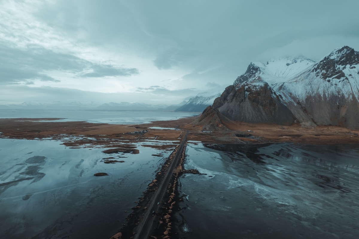
Iceland’s terrain, weather, and road network reward preparation. International mapping apps are fine for navigation, but several Iceland-specific tools are essential for understanding what the weather is actually doing in the mountains, whether a road is passable, and how to get help if something goes wrong. These are not edge-case tools for extreme adventurers — they are relevant to every self-drive traveller in Iceland.
Weather: Veður.is
The single most important digital tool for travelling in Iceland is the Icelandic Meteorological Office weather service: veður.is (English version: en.vedur.is). The iOS and Android app is called Veður.
Why not just use Apple Weather or Google Weather? International weather services use interpolated regional data for Iceland, which smooths over the rapid, localised changes in Icelandic weather. Conditions on a mountain pass can be category-two storm force while Reykjavík 60km away is clear. Veður.is draws from a network of over 150 weather stations around Iceland, giving granular forecasts for specific locations — including mountain passes, highland roads, and coastal exposures.
What to check daily:
- Wind warnings: Iceland uses a colour-coded alert system (yellow, orange, red). Orange and red alerts mean significantly dangerous conditions — reduced visibility, high winds (often exceeding 25–35 m/s), potential vehicle instability. Do not drive across exposed highland roads in orange or red alert conditions.
- 14-day forecast by location: Select your specific region (South Coast, Westfjords, North Iceland, East Iceland) for localised predictions
- Wave alerts: Relevant if you are on coastal routes in bad weather
- Special weather announcements: Issued when conditions are forecast to be exceptional
The weather forecast changes quickly in Iceland. Check every morning. What was forecast 48 hours ago may not reflect current conditions.
Road Conditions: road.is
road.is (the website of Vegagerðin, the Icelandic Road Administration) is the official and most comprehensive source for road status.
What road.is shows:
- Current status of every named road in Iceland (open / restricted / closed)
- Whether roads require 4WD (updated in real time)
- Whether F-roads are open for the season (F-roads typically open late May through June and close September through October)
- Live camera feeds from key junctions and mountain passes
- Snow depth and visibility at mountain passes
The F-road rule: F-roads are closed in winter. The opening dates vary by road and by year — an F-road shown as “closed” on road.is is not passable regardless of the weather you can see around you. Driving on a closed F-road invalidates your rental car insurance and can trigger a significant fine.
The road.is app (called Vegferðastofa in some app stores, or accessible via browser) works on mobile. The Iceland Road Guide website (built on road.is data) provides a map-based view that is sometimes easier to read quickly.
SafeTravel: safetravel.is
The SafeTravel app (safetravel.is) is operated by the Icelandic Association for Search and Rescue (ICE-SAR), the organisation that coordinates rescue operations in Iceland. The app has two core functions:
1. Trip registration (Traveller Registration): Before any trip into remote areas — hiking in the highlands, driving F-roads, camping in isolated areas — you can file a trip plan. You enter your planned route, number of people, vehicle, and expected return time. If you do not check in by your return time, ICE-SAR can act on the registered information. This is particularly important for:
- Multi-day highland treks (Laugavegur trail, Fimmvörðuháls)
- F-road drives in the interior
- Any remote camping when weather is forecast to deteriorate
2. Alerts: The app provides push notifications for severe weather warnings, volcanic eruptions, and other safety-relevant events. This is the fastest route to receiving official alerts — faster than checking multiple websites.
The trip registration is free and takes under 5 minutes. Using it is not over-cautious — ICE-SAR explicitly encourages all travellers (not just hikers) to register trips in remote areas. The Reykjanes volcanic zone (active since 2021) has made eruption alerts particularly relevant for travellers on the southwest peninsula.
Navigation: Google Maps and What.Three.Words
Google Maps works in Iceland with full offline map support. Download the Iceland map before travel — mobile coverage gaps exist in the highlands and in parts of the Westfjords. Google Maps works well for Ring Road driving and South Coast travel.
Apple Maps is significantly less comprehensive for Iceland’s road network and performs poorly on F-roads and remote routes. Use Google Maps.
What.Three.Words (W3W): This global location system divides the world into 3m × 3m squares, each with a unique three-word address (e.g. ///frozen.hills.lake). It is useful in Iceland for two reasons:
- Many natural sites have no street address — Google Maps can find “Reynisfjara” but W3W can pinpoint the specific parking lot entrance or hiking trail start
- Icelandic emergency services (including ICE-SAR) accept W3W location codes — if you need to call for help from a remote location, giving your W3W address is faster and more precise than coordinates
The W3W app works offline after downloading the relevant tile.
Aurora Forecasting
Aurora borealis visibility requires three conditions to align: geomagnetic activity (Kp index ≥ 3), darkness (only possible September–March in Iceland), and clear skies. No aurora forecasting tool is reliable beyond 2–3 days — geomagnetic activity comes from solar wind conditions that cannot be predicted far in advance.
Best tools:
- Veðurvaktin (iOS/Android): Developed by Icelandic meteorologist Þórður Ársælsson specifically for Iceland aurora forecasting. Shows local cloud cover maps overlaid with aurora probability — more useful than global Kp apps for Iceland specifically
- Space Weather Live (iOS/Android): Shows current and forecast Kp index globally; set an alert for Kp ≥ 3
- en.vedur.is aurora forecast: The official IMO aurora forecast page, updated regularly
Practical note: Even when all three conditions align, you need to be away from light pollution. Reykjavík itself is bright enough to wash out moderate aurora. Driving 20–30 minutes outside the city improves prospects significantly.
Strætó: Public Bus in Iceland
Strætó (the national bus service) has an iOS and Android app showing Reykjavík city bus routes and the long-distance Strætó bus network. For Reykjavík city travel, the app includes real-time bus locations, route planning, and the ability to buy single tickets or upload pass credits.
Strætó covers:
- Reykjavík city buses (routes 1–55 and above)
- Long-distance bus routes to Akureyri, the Westfjords, the Snæfellsnes Peninsula, and some South Coast stops
What Strætó does not cover: Most of Iceland’s key attractions. The bus network does not reach the South Coast waterfalls, Jökulsárlón, Mývatn, Þingvellir, or most highland areas. For independent travel beyond Reykjavík, a rental car is effectively required.
Reykjavík Excursions (RE, re.is) and Sterna (sterna.is) operate express buses and tour connections from the BSÍ bus terminal in Reykjavík to key South Coast sites and the highlands in summer. These are separate from Strætó and have their own booking apps/websites.
Appy Hour: Reykjavík’s Happy Hour Tracker
Appy Hour (iOS/Android) is Iceland’s beloved bar-discount app — tracking which Reykjavík bars currently have happy hour prices. Given that an average Reykjavík beer costs approximately ISK 1,500–1,900 outside happy hour (as of 2026), happy hour prices of ISK 700–1,000 represent significant savings over a night out.
The app shows a list of bars by proximity with current happy hour status and the deal available. In Reykjavík, happy hours typically run from mid-afternoon to around 8–9pm. The app is free and updated in real time.
It is distinctly not essential infrastructure in the way that Veður.is and road.is are — but it is a genuinely useful tool for budget-conscious travellers and a well-known part of the Reykjavík visitor toolkit.
Geothermal Pool Finder: Hot Pot Iceland
Hot Pot Iceland is a community-maintained database of public geothermal pools and natural hot springs around Iceland, including many that do not appear on standard mapping apps. The map shows:
- Municipal pools (laugar) with opening hours and fees — typically ISK 900–1,200 per adult as of 2026 for Reykjavík pools
- Natural hot springs (free and wild)
- Privately operated hot pools
The app is particularly useful for finding natural hot springs in the Westfjords and the highlands — some require significant driving on gravel roads to reach, but the database includes user-added access notes.
Emergency Numbers
These are not apps but should be saved to your phone before travel:
- 112: Emergency number for all services in Iceland (same as 999 in the UK or 911 in the US)
- 1-7-7: Non-emergency police line
- ICE-SAR hotline: +354 570 5900 (search and rescue, non-emergency contact)
- Vegagerðin road info: +354 522 1000
The 112 Iceland app (available on iOS and Android) allows you to send your GPS location directly to Icelandic emergency services with a single button press — particularly useful in areas with poor data connectivity where calling is difficult.
Book an experience
Top tours to book now
Already planning? These are the most popular experiences for this destination.
Frequently Asked Questions
- Is there a reliable weather app specifically for Iceland?
- Yes — Veður.is (the Icelandic Meteorological Office) is more accurate for Iceland than international apps like Weather.com or Apple Weather, which use interpolated regional data. Veður.is pulls from Iceland's dense network of weather stations and has a 14-day forecast with specific mountain and coastal alerts. The English version is available at en.vedur.is and the iOS/Android app (Veður) is free.
- What is road.is and why do I need it?
- road.is (Vegagerðin, the Icelandic Road Administration) is the official source for road conditions, closures, and difficulty ratings across Iceland. Every road in Iceland has a daily status (open, restricted, closed) updated multiple times daily. F-roads (highland roads) have specific status updates as they open in late May/June and close in September/October. Before any drive in Iceland — particularly in spring, autumn, or after weather events — check road.is.
- Do I need the SafeTravel app or is it just for hikers?
- SafeTravel (safetravel.is) is useful for all travellers, not just hikers. The app includes the Traveller Registration system where you can file a trip plan — useful if driving remote roads or hiking in the highlands, as it ensures emergency services know your intended route if you do not check back in. It also provides real-time alerts for severe weather and volcanic activity. The app is free.
- Is there a good app for finding petrol stations in Iceland?
- The Gas Stations Iceland app (or simply using Google Maps with 'petrol station' search) shows N1, Orkan, and ÓB stations with current prices. In remote areas, stations are sparse — on the Ring Road east of Vík toward Höfn, there is a 200km+ stretch with limited fuel options. Refilling at every opportunity in rural Iceland is a better strategy than relying on finding the next station when low.
- What apps help predict aurora borealis in Iceland?
- The most reliable are: Veðurvaktin (an aurora-specific app by Icelandic meteorologist Þórður Ársælsson), the Space Weather Live app (shows Kp index globally), and the aurora forecast on en.vedur.is. Aurora is only visible when Kp index is 3 or above, cloud cover is low, and it is fully dark (so not in summer). Veðurvaktin shows local cloud cover specifically over Iceland correlated with aurora probability — more useful than generic global apps.