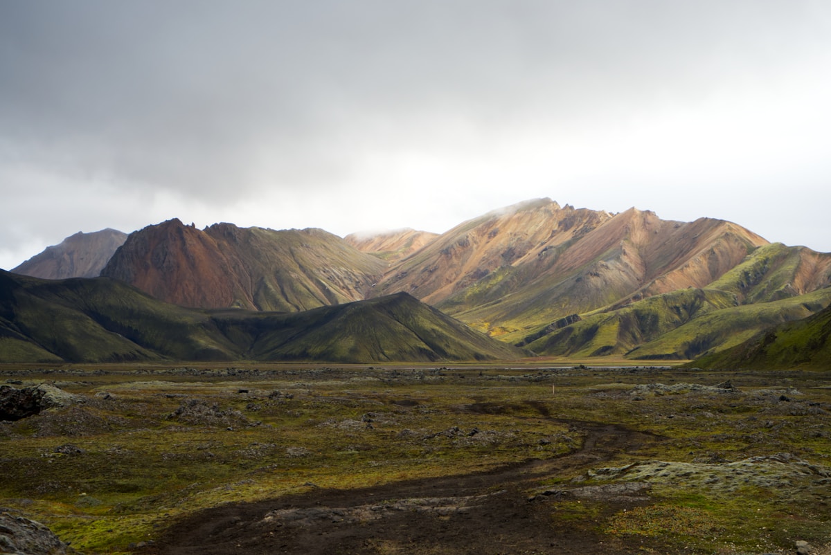
Landmannalaugar is the best day hiking base in Iceland’s Highlands. The area sits in a bowl of multicoloured rhyolite mountains - greens, pinks, yellows, and purples - surrounded by obsidian lava fields and geothermal vents. Four clearly marked day hike routes cover the main terrain, ranging from a short stroll to a half-day circuit.
Getting There
By Highland Bus (Reykjavík Excursions) from Reykjavík or Selfoss - approximately ISK 8,900 one way as of 2026. Season approximately mid-June to mid-September.
By 4WD via Route F208 with river crossing. Not accessible by standard cars.
Brennisteinsalda Loop (3–4 hours, ~8km)
The most popular day hike from Landmannalaugar. A circuit around and over the Brennisteinsalda rhyolite mountain - ‘Sulphur Wave’ - one of the most colourful peaks in the area. The route passes through geothermal areas with steaming vents and sulphurous yellow ground before ascending to views over the full Landmannalaugar highland plateau.
Starting point: Hut area. Trail is clearly marked. Elevation gain approximately 300m.
Difficulty: Moderate. Some loose scree on the ascent. Recommended for most hikers.
Highlights: Rhyolite colour at its most intense; views over the lava field and Frostastaðavatn lake; geothermal steam at close range.
Bláhnúkur (2–3 hours, ~6km)
‘Blue Peak’ - a 943m obsidian volcano summit rising above the lava field. The ascent is steep on loose black volcanic rock (trekking poles helpful). The summit gives 360° views over the entire highland plateau - Mýrdalsjökull, Tindfjöll mountains, the rhyolite ridges, and the lava field below.
Difficulty: Moderate to challenging. Steep, loose terrain on upper section. Take care on descent.
Starting point: From the hut area, cross the lava field to the base of the peak. About 20 minutes to reach the base.
Frostastaðavatn Lake Circuit (2–3 hours, ~7km)
A circuit around the lake south of Landmannalaugar, passing through rhyolite hills and providing views of the surrounding mountains from a different angle than the Brennisteinsalda loop. Good for those who have already done Brennisteinsalda.
Difficulty: Moderate. Some uneven terrain but no significant elevation gain.
Ljótipollur Explosion Crater Lake (~full day, 12km return on foot or shorter by 4WD)
‘Ugly Puddle’ - a vivid red and orange explosion crater with a deep teal lake inside. The name is characteristically Icelandic in its understatement; the colours are extraordinary. Located approximately 5km north of Landmannalaugar.
Access: On foot it’s a long day return (approximately 5–6 hours round trip). Some 4WD tours visit by vehicle. Guided tours from the hut are available.
Lava Field Walk (30–60 minutes, 1.5km)
The Laugahraun lava field is directly accessible from the hut area - a short marked path crosses the edge of it. The obsidian rock formations are dramatic at close range. Good for acclimatising or for visitors with limited time. Easy.
The Natural Hot Spring Pool
A geothermal pool fed by hot spring water sits at the edge of the Laugahraun lava field — free to use and one of the genuine highlights of any visit. Water temperature varies by section; some areas are scalding-hot and better to observe than enter. The cooler mixing zones are comfortable for a soak. Swimsuit and towel are essential. Changing facilities at the hut. The pool is best early morning (before day bus arrivals) or late evening.
Camping: FÍ campsite charges approximately ISK 2,100 per person per night. Running water, basic toilets. For a shower, use the hut facilities (approximately ISK 800–1,000). Arriving the evening before gives early-morning trail access ahead of bus day-trippers.
Practical Notes
- All trails are above 600m - weather changes faster here than in the valleys
- The hot spring pool is free to use and is a genuine highlight regardless of which trail you do
- Trail conditions change after rain or snow - ask the hut wardens about current conditions
- The hut has a basic café selling hot soup and snacks (approximately ISK 1,200–1,800 per bowl)
- Firewood and fires are not permitted - bring a camp stove if cooking independently
Book Laugavegur trek options - guided and self-guided packages with luggage transfers available.
Get travel insurance for Iceland - policies covering glacier hikes, F-road driving, and volcanic disruption.
Compare car hire in Iceland - a 4WD or campervan gives the flexibility to explore at your own pace.
Related Guides
- Landmannalaugar city guide - Getting there, when to visit, and what to do in this remote highland location
- Laugavegur trail - The multi-day highland trek starting at Landmannalaugar: what to expect and how to plan
- Iceland F-roads guide - Landmannalaugar is only accessible via highland F-roads: essential reading before you drive
- Iceland highlands guide - The wider highland region and other destinations in Iceland’s uninhabited interior
For accommodation before and after the trek, Search hotels in Landmannalaugar on Booking.com.