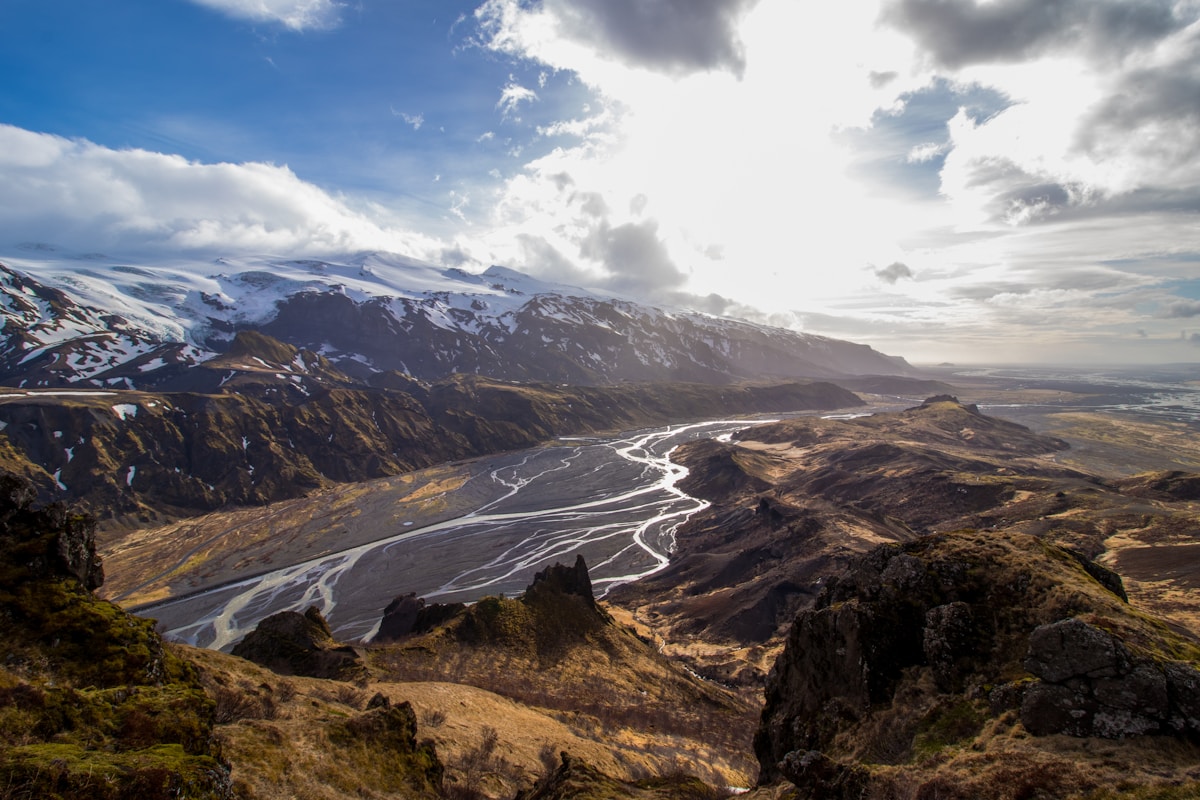
Þórsmörk (‘Thor’s Forest’) is a highland valley system at 200m altitude in South Iceland, enclosed by three glaciers: Eyjafjallajökull, Mýrdalsjökull, and Tindfjallajökull. The combination of glaciers visible in three directions, birch and willow woodland in the valley floor, and dramatic ridge hiking above the treeline makes it the best hiking base in South Iceland.
Getting There
Highland Bus: Reykjavík Excursions (re.is) and Trex (trex.is) run scheduled services from Reykjavík BSÍ terminal and Selfoss. One way approximately ISK 7,900–9,500. Seasonal service in summer (June–September). Super-jeep-style buses handle the river crossings on Route F249. You can also compare bus options on Omio.
Self-drive: Route F249 from Route 1 near Hvolsvöllur. Multiple river crossings required - only for properly equipped 4WDs with experience. The crossings can be knee-deep and fast-moving.
Valahnúkur (2–3 hours return, 5km)
The most popular day hike in Þórsmörk. A 466m peak immediately above the hut area, with a marked trail of switchbacks through birch woodland and then rocky ridge. The summit view encompasses all three surrounding glaciers, the Þórsmörk valley floor, and on clear days the South Coast.
Difficulty: Moderate. Steep in places but no technical difficulty. A 2-hour round trip at comfortable pace. Most hikers do this as their first afternoon activity after arriving.
Goðaland Ridge (4–6 hours, 10–14km)
The area east of the main hut area, called Goðaland (‘Land of the Gods’), has more exposed ridge hiking with dramatic views of Eyjafjallajökull and the Markarfljót river gorge. The terrain is rougher and some sections involve scrambling.
Multiple trail variations are possible. Ask the hut wardens for a current map and condition update. This area is less crowded than the Valahnúkur trail.
Difficulty: Moderate to challenging. Some scrambling on exposed ridge sections.
Tindfjöll Circuit (5–7 hours, ~15km)
A longer circuit through the Tindfjöll mountains east of the main Þórsmörk area. This route gives the most remote feel of any day hike from Þórsmörk - fewer visitors, wilder terrain. Requires navigation skills and a proper trail map.
Difficulty: Challenging. Longer with more elevation gain than the other options.
Valley Walks (1–2 hours, easy)
The valley floor has easy paths through birch and willow woodland - good for a short walk or for those with children. The woodland is unusual in Icelandic highland terms - the sheltered position between glaciers creates a microclimate warm enough for vegetation that doesn’t survive elsewhere at this altitude.
Fimmvörðuháls (departure point)
Þórsmörk is the northern end of the Fimmvörðuháls trail to Skógafoss (25km, 8–10 hours). See the separate Fimmvörðuháls trail article for the full route description.
When to Visit
Peak season (July–August): All buses run, huts fully open, trails snow-free. Book accommodation 2–3 months ahead. Valahnúkur gets crowded mid-morning; start before 9am for solitude and better light on the glaciers.
June and September: Quieter, similar weather. Late June the bus service begins; September has shorter days but rich golden-hour light for photography. Snow may linger on Goðaland ridges in early June.
Day trip vs overnight: A bus day trip (8–9 hours total including transit) is feasible but leaves only 3–4 hours on the trails. A single overnight changes everything — arriving the evening before gives a full hiking day without racing the last bus back to Reykjavík.
Accommodation and Facilities
Search hotels in Þórsmörk on Booking.com
Langidalur Hut (FÍ): Sleeping bag dormitories, approximately 60 beds. ISK 8,900 per person per night. Camping also available. Book at fi.is.
Húsadalur (Volcano Huts): Larger facility with more beds, a café/restaurant, and camping. ISK 8,500+ per person in dorms. Book at volcanohuts.com. The café sells hot meals, soup, and snacks.
Básar Hut (Útivist): A third hut in the area, operated by the Útivist hiking club. Book at utivist.is.
Book Laugavegur trek options - guided and self-guided packages with luggage transfers available.
Get travel insurance for Iceland - policies covering glacier hikes, F-road driving, and volcanic disruption.
Compare car hire in Iceland - a 4WD or campervan gives the flexibility to explore at your own pace.
Related Guides
- Fimmvörðuháls trail - The 25km trail from Þórsmörk to Skógafoss: a full-day hike across the mountain pass
- Laugavegur trail - The multi-day route from Landmannalaugar that ends at Þórsmörk
- Þórsmörk city guide - Overview of the whole area: getting there, F-road access, and seasonal conditions
- Selfoss travel guide - The nearest significant town with full services for Highland trips
- South Coast drive - Þórsmörk can be combined with the South Coast on a longer itinerary