Lake Mývatn sits at the centre of one of the most geologically dense regions in Iceland. Within an hour’s drive you can reach Europe’s most powerful waterfall, an active volcanic caldera, a horseshoe canyon that was supposedly created by Odin’s horse, and a waterfall that gave Iceland its name. The lake itself deserves a full day - but if you have two or three nights, the surrounding area opens up considerably.
Krafla Volcano and Víti Crater Lake
Distance from Mývatn: 7km north on Route 863 - approximately 10 minutes by car
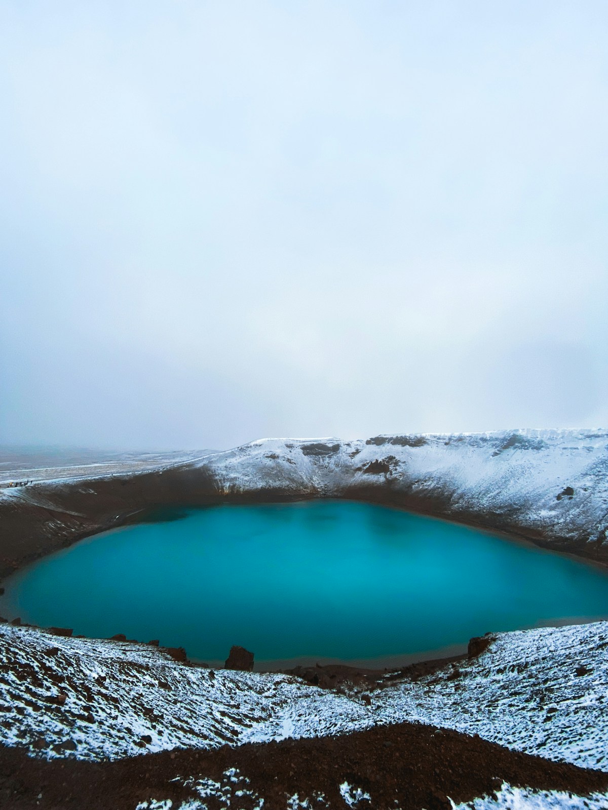
The Krafla central volcano last erupted in 1984 and remains geothermally active. The road up from Route 1 passes the Krafla geothermal power plant before reaching the parking area below the caldera. From there it’s a short walk to the rim of Víti, a flooded explosion crater with vivid turquoise water - the colour comes from dissolved minerals and geothermal heating. The walk to the crater rim takes approximately 15 minutes; the circuit around it takes another 20.
Entry is free. No booking required. In summer the road is open to standard vehicles. In winter and early spring, snow can make access unpredictable - check road.is before driving up.
From Krafla, the walking trail continues towards Leirhnjúkur lava field - a 3–4km circuit across recent lava (some from the 1984 eruption) with active fumaroles and low-level sulphur venting. Combine Krafla and Leirhnjúkur in the same morning without rushing.
Hverir (Námaskarð) Geothermal Field
Distance from Mývatn: 5km east on Route 1 - approximately 5 minutes by car
The most otherworldly landscape in the Mývatn area. Hverir (sometimes called Námaskarð) is a field of boiling mud pools, steam vents, and sulphur deposits at the foot of Námafjall mountain. The ground is orange and yellow, the mud pots bubble continuously, and the smell of hydrogen sulphide is noticeable throughout.
Boardwalks and marked paths allow you to walk among the active vents safely. Stay on the paths - the thin crust between active areas is not always stable. Entry is free. No facilities beyond a small parking area. Allow 30–45 minutes.
Most visitors combine Hverir with Krafla on the same morning, stopping on the drive up. The two together make a complete half-day from the lake.
Dimmuborgir Lava Field and Hverfjall Crater
Distance from Mývatn: 4km south of Reykjahlíð on Route 848
Dimmuborgir is a dramatic lava field where ancient lava tubes collapsed to create a maze of arches, towers, and caves. Marked trails of varying lengths (shortest approximately 30 minutes, longest around 2 hours) wind through the formations. The area is associated in Icelandic folk tradition with the Yule Lads - the thirteen troll-like characters who deliver gifts to children in the days before Christmas.
Immediately north of Dimmuborgir is Hverfjall, a tephra crater approximately 1km wide and 160m deep, formed in an eruption around 2,500 years ago. A marked trail leads to the crater rim - the ascent takes 15–20 minutes on a clear path. The view from the rim over the lake, the surrounding craters, and the Krafla massif on a clear day is one of the best panoramas in north Iceland. The descent takes approximately the same time.
Entry to both Dimmuborgir and Hverfjall is free. Parking at Dimmuborgir has a small fee (approximately ISK 700 as of 2026).
Goðafoss - Waterfall of the Gods
Distance from Mývatn: 50km west on Route 1 - approximately 40 minutes by car
Goðafoss (‘waterfall of the gods’) gets its name from a moment in Iceland’s history: in 1000 CE, the lawspeaker Þorgeir Ljósvetningagoði reportedly threw his Norse idols into the falls after deciding at the Althing that Iceland would officially adopt Christianity. Whether historically accurate or not, the name has held.
The waterfall itself spans approximately 30m and drops 12m across a curved basalt ledge. In summer, the water levels are highest from glacial melt. The short walk from the parking area to the best viewpoints on both banks of the river takes around 15 minutes total. Entry is free. No facilities beyond parking and toilets.
Goðafoss combines naturally with a drive into Akureyri (30km further west), making it a practical lunch-and-grocery stop before the drive back to Mývatn in the afternoon.
Dettifoss - Europe’s Most Powerful Waterfall
Distance from Mývatn: 65–80km northeast - approximately 1 hour to 1 hour 30 minutes by car
Dettifoss carries more water per second than any other waterfall in Europe - approximately 193 cubic metres per second on average, rising significantly in summer glacial melt. The falls are 44m high and 100m wide, and the roar and spray are audible and visible from the parking area before you reach the rim. It is a genuinely overwhelming sight.
There are two approaches:
- Route 862 (west bank): Paved road, accessible to all vehicles. The viewpoint looks directly into the falls from the west rim.
- Route 864 (east bank): Unpaved gravel, slower but passable in standard 2WD cars in summer. Viewpoints differ slightly; many prefer the east bank for photography.
Selfoss - 1km upstream from Dettifoss, a wider and shallower falls with a different character - is accessible via a short walkway and worth including in the same visit. Allow 2–3 hours total for Dettifoss and Selfoss combined.
Entry to Dettifoss is free. Parking requires payment (approximately ISK 1,000 as of 2026). No café or facilities beyond toilets.
Ásbyrgi Canyon
Distance from Mývatn: 100km northeast - approximately 1 hour 15 minutes by car
Ásbyrgi is a horseshoe-shaped canyon approximately 3.5km long and 1km wide with walls rising to 100m on three sides. Norse myth holds that it was created when Sleipnir, Odin’s eight-legged horse, touched the ground briefly during a ride. The scientific explanation - a catastrophic glacial flood from Vatnajökull erupting under ice thousands of years ago - is arguably more dramatic.
The canyon floor is wooded with birch and rowan, unusual in Iceland’s otherwise largely treeless landscape. Marked trails range from a short forest walk (30 minutes) to the full canyon circuit (3–4 hours). A small pond at the base of the northern cliff face, Botnstjörn, reflects the canyon walls.
Entry is free; Ásbyrgi is within Vatnajökull National Park. The visitor centre at the canyon entrance has maps, toilet facilities, and a small exhibition.
Ásbyrgi works best as a full-day loop from Mývatn combined with Dettifoss and Selfoss - the three sites together cover approximately 200km and take a full 8–9 hours with walking time included. For more of north Iceland’s highlights, see our Húsavík day trips guide, which covers additional sites in the wider Diamond Circle area.
Browse Lake Mývatn tours - guided tours covering the geothermal area, Dimmuborgir, and Grjótagjá cave.
Compare car hire in Iceland - a 4WD or campervan gives the flexibility to explore at your own pace.
See Also
- Lake Mývatn city guide - Full area guide: what to see, where to stay, and how to get there
- Dettifoss visitor guide - Europe’s most powerful waterfall: approach routes, viewpoints, and logistics
- Húsavík city guide - Whale watching capital 60km north, naturally combined with the Diamond Circle
- Akureyri city guide - 100km west: North Iceland’s main hub for accommodation and services
- Waterfalls guide Iceland - Goðafoss, Dettifoss, and Iceland’s other major falls compared
For accommodation nearby, Search hotels in Mývatn on Booking.com.