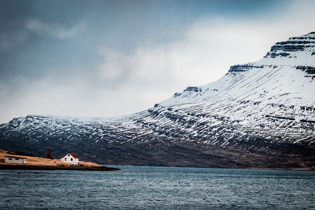
The east of Iceland is the region most Ring Road drivers rush through. That’s a mistake. The East Fjords are slower, quieter, and more varied than anywhere else on the route - deep blue fjords backed by steep mountains, tiny fishing villages strung along narrow coastal roads, and two of Iceland’s most rewarding day trips within an hour of Egilsstaðir. This route takes 2–4 days depending on pace and covers approximately 250km of driving once you’re in the region.
Getting to East Iceland
Egilsstaðir is roughly halfway around the Ring Road from Reykjavík - approximately 700km driving east (around 7–8 hours direct). Most travellers arrive as part of a full Ring Road circuit.
Alternatively, Egilsstaðir has a regional airport with flights from Reykjavík domestic on Air Iceland Connect - approximately 45 minutes, from around ISK 15,000–25,000 one way. Flying in and hiring a car in Egilsstaðir is a practical option if you want to focus time on the east rather than driving transit.
Hire a car in Iceland well in advance - summer demand is high and Egilsstaðir’s car hire options are limited compared to Reykjavík.
Day 1: Egilsstaðir and Lagarfljót
Driving: 40–50km loop. Time: 3–4 hours including stops.
Egilsstaðir sits at the top of Lagarfljót - a long, narrow lake that runs roughly southwest from the town. The lake is Iceland’s third largest and the source of one of the country’s best folklore traditions: the Lagarfljótsormur, a worm-like monster said to have been terrorising the lake since at least the 14th century.
Start the day with the Lagarfljót loop drive. Head south along Route 931 on the west bank and return on Route 932 on the east bank (or vice versa - both banks offer views across the dark, still water).
Hallormsstaðaskógur (roughly 25km south of Egilsstaðir on Route 931) is Iceland’s largest forest - which sounds underwhelming but the birch and larch woodland is genuinely lovely, especially in autumn when the colours turn. There’s a campsite and a small visitor area. Free access, no entry fee.
Skriðuklaustur is a historic manor house and monastery ruins on the eastern bank, now a cultural centre and café. The building itself is interesting - designed by Icelandic architect Guðjón Samúelsson and built in 1939. Open daily in summer, ISK 1,500 entry as of 2026 (verify current price at skriduklaustur.is).
Accommodation in Egilsstaðir:
- Gistihúsið Lake Hotel - central hotel with good facilities, doubles from approximately ISK 22,000–30,000.
- Campsite at Egilsstaðir - well-maintained municipal site, from approximately ISK 2,500 per person per night.
Day 2: Hengifoss and the Lagarfljót Gorge
Driving: 30km from Egilsstaðir. Hike: 2.5–3 hours return. Time: half day.
Hengifoss is the third-highest waterfall in Iceland at 128m. It’s in a spectacular setting - a narrow gorge with distinctive red and black horizontal banding in the basalt cliff face, caused by ancient layers of red clay sediment between lava flows. The waterfall drops in a clean, narrow ribbon over the layered cliff.
The trail to Hengifoss begins at a car park on Route 931, about 30km south of Egilsstaðir. The walk is 2.5km each way with around 400m of elevation gain - manageable but steady. Allow 2.5–3 hours for the full return trip.
Litlanesfoss is passed en route to Hengifoss and is worth stopping for in its own right. A curtain of hexagonal basalt columns surrounds the 30m fall - one of the more photogenic waterfall settings in the east. It’s about halfway up the trail to Hengifoss.
The trail is signposted and well-maintained but can be muddy after rain. Proper footwear is essential. No entry fee. Trail open year-round but the upper section can be icy in winter.
After the hike, return to Egilsstaðir and continue north on Route 94 toward Borgarfjörður Eystri (optional extension - see below) or save the afternoon for Seyðisfjörður the following day.
Day 3: Seyðisfjörður
Driving: 27km from Egilsstaðir, approximately 30–40 minutes. Time: full day.
Seyðisfjörður is the most visually striking town in East Iceland and one of the most photogenic places in the country. The approach alone is worth the visit - Route 93 drops over a mountain pass and descends along a series of switchbacks into a deep, steep-sided fjord, with waterfalls on both sides of the valley and the blue-and-white wooden houses of the town visible far below.
The town is Seyðisfjörður’s main settlement - roughly 700 people - but it punches well above its size culturally. The Blue Church (Blái kirkjan) on the famous rainbow-painted street is the most photographed scene. The painted rainbow path leads from the ferry terminal to the church and has become genuinely iconic.
Smyril Line ferry terminal - Seyðisfjörður is Iceland’s main international ferry port. The Norröna sails weekly to the Faroe Islands and Denmark (Hirtshals). Even if you’re not catching a ferry, the harbour is interesting and the ferry schedule brings a cosmopolitan feel to the town in summer.
Tvísöngur sound sculpture - a concrete installation up the hillside above the town, designed by German artist Lukas Kühne. Five interconnected resonance chambers, each tuned to a note of traditional Icelandic harmony. Worth the 15-minute walk up for both the sculpture and the views.
Hiking above the fjord: Several marked trails lead up the steep valley sides above Seyðisfjörður. The hike to Vestdalsfossar (a series of waterfalls on the west side of the fjord) takes 3–4 hours return and offers extraordinary views back down the fjord. Difficulty: moderate.
Accommodation in Seyðisfjörður:
- Hótel Aldan - four historic buildings in the town centre, doubles from approximately ISK 30,000–45,000. The most atmospheric hotel in East Iceland.
- Campsite - small municipal site near the old fish factory, from approximately ISK 2,000 per person.
Many travellers base themselves in Egilsstaðir and day-trip to Seyðisfjörður, which works well. But staying a night in Seyðisfjörður - especially in early summer when the ferry arrives in the afternoon and the town is lively - is a memorable experience.
Optional Extension: East Fjords Villages
Driving: 120km one-way on Route 1/Route 92 south to Djúpivogur. Time: half to full day.
The East Fjords coast road runs south from Egilsstaðir past a string of tiny villages tucked into fjord heads - Fáskrúðsfjörður (with French fishermen’s history and signs still bilingual in French), Stöðvarfjörður (home to Petra’s Stone Collection, one of Iceland’s quirkier museums - free entry, worth 30 minutes), and Breiðdalsvík before the road rejoins the Ring Road.
This stretch is quiet and beautiful. Allow 3–4 hours to drive the fjords slowly with stops, or half a day if you want to walk any of the short coastal paths.
Optional Extension: Borgarfjörður Eystri
Driving: 70km north of Egilsstaðir on Route 94. Time: full day.
Borgarfjörður Eystri (also called Bakkagerði) is one of Iceland’s best puffin-watching spots - Atlantic puffins nest in large numbers on the rocky headland at Hafnarhólmi, just below the town. A purpose-built viewing platform puts you within a few metres of nesting birds from mid-May through August. Free access.
The area is also excellent for hiking - the Dyrfjöll mountains above the village offer challenging routes with dramatic views. The village itself has a small church, a handful of guesthouses, and a good café.
The road to Borgarfjörður Eystri (Route 94) is mostly paved but partly gravel - accessible in a 2WD in summer, though the last section requires care after rain.
Practical Notes
Fuel: Fill up in Egilsstaðir before heading to Seyðisfjörður or Borgarfjörður Eystri - fuel options at those destinations are limited. The Ring Road has stations roughly every 50–100km.
Road conditions: Route 93 to Seyðisfjörður closes frequently in winter and early spring due to snow and avalanche risk. Always check road.is before driving this route outside June–September. The Seyðisfjörður road is one of Iceland’s most commonly closed passes.
Crowds: The East Fjords see far fewer tourists than Reykjavík, the Golden Circle, or the South Coast. Accommodation books up in July and August but not at the frenetic rate of more visited regions. May, June, and September offer excellent conditions with fewer visitors.
Phone signal: Good in Egilsstaðir and Seyðisfjörður, intermittent in the fjord villages, absent on many mountain roads. Download offline maps before leaving.
Best season: Late June through August for reliable road access and long daylight. Early September is excellent - some midrange accommodation has reduced rates and the autumn colour in Hallormsstaðaskógur is beautiful. Winter visits to Seyðisfjörður specifically are possible but require checking road closures daily.
Suggested Route Summary
| Day | Route | Driving | Key Stops |
|---|---|---|---|
| 1 | Egilsstaðir + Lagarfljót loop | 40–50km | Hallormsstaðaskógur, Skriðuklaustur |
| 2 | Egilsstaðir → Hengifoss → return | 60km | Hengifoss, Litlanesfoss |
| 3 | Egilsstaðir → Seyðisfjörður → return | 54km | Blue Church, Tvísöngur, Vestdalsfossar hike |
| +1 (opt) | Egilsstaðir → East Fjords → Ring Road | 120km | Petra’s collection, fjord villages |
| +1 (opt) | Egilsstaðir → Borgarfjörður Eystri → return | 140km | Puffins, Dyrfjöll mountains |
Related Guides
- Ring Road Iceland - The East Fjords form part of the full Ring Road circuit; detailed route notes across all regions
- East Fjords city guide - Overview of the entire East Fjords region and all main settlements
- Egilsstaðir travel guide - Accommodation, restaurants, and day-trip options from the East’s main town
- Seyðisfjörður travel guide - The Blue Church, ferry port, hiking trails, and where to stay