The Diamond Circle is north Iceland’s answer to the Golden Circle: a loop of waterfalls, geothermal ground, a canyon and a whale-watching harbour, all within roughly 250 km of driving. It is quieter than the south and, in our view, more varied. This page is the route itself: the order of stops, the distances between them and the road details that matter. For a multi-day itinerary built around Akureyri, see our North Iceland road trip.
Route at a glance
| Leg | Road | Approx. distance | Drive time |
|---|---|---|---|
| Akureyri to Goðafoss | Route 1 | 45 km | 35 min |
| Goðafoss to Mývatn | Route 1 | 50 km | 40 min |
| Mývatn to Húsavík | Route 87 / 85 | 55 km | 45 min |
| Húsavík to Ásbyrgi | Route 85 | 65 km | 55 min |
| Ásbyrgi to Dettifoss | Route 862 | 30 km | 30 min |
| Dettifoss to Mývatn | Route 862 / 1 | 60 km | 50 min |
Distances are approximate and drive times assume dry summer roads.
Where to start
Most visitors start from Akureyri or from Mývatn. Starting at Akureyri adds about 100 km each way but lets you see Goðafoss on the way. If you are already sleeping near Mývatn, start there and take the loop clockwise: Húsavík first, then Ásbyrgi, then Dettifoss on the way back, so you finish at the most powerful waterfall in the afternoon. See Akureyri and Mývatn for where to base yourself.
Stop 1: Goðafoss
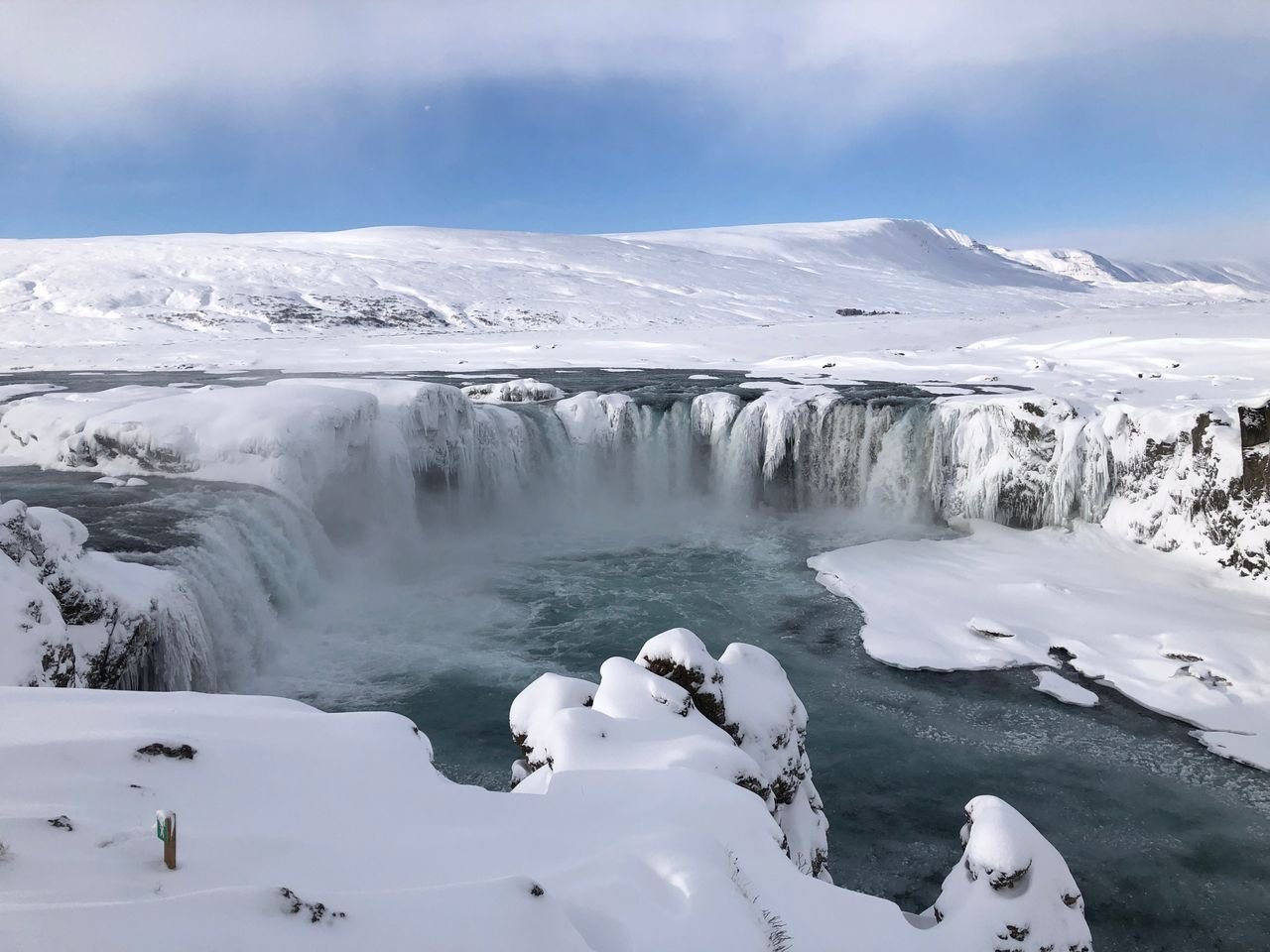
Goðafoss, the “waterfall of the gods”, is about 12 metres high and 30 metres wide, and sits right beside Route 1 with a car park on both banks. The west bank is the quicker stop, the east bank gives the classic horseshoe view. Allow 30 to 45 minutes. It is free, and busiest between 11:00 and 15:00, so arrive early or late.
Stop 2: Mývatn
Lake Mývatn needs half a day on its own. The compact highlights are:
- Hverir: boiling mud pots and fumaroles beside Route 1, smelling of sulphur. Stay on the marked paths, the ground is scalding.
- Dimmuborgir: lava formations with short marked walks of 1 to 2.3 km.
- Grjótagjá: a lava cave with a thermal pool, no longer safe or permitted for bathing.
- Mývatn Nature Baths: the quieter northern alternative to the Blue Lagoon. Pre-booking is advisable in summer.
For detail on each, read our Mývatn things to do guide, and book a Mývatn tour if you prefer not to drive the whole circuit.
Stop 3: Húsavík
Húsavík is Iceland’s whale-watching capital, set on Skjálfandi Bay. Tours of about three hours run from the harbour, with humpback sightings frequent in summer. Even if you skip the boat, the harbour cafes and the Whale Museum are worth an hour. Our Húsavík guide covers tour operators, and you can compare options through Húsavík whale watching tours. The Diamond Circle is also the best moment to read whale watching in Iceland before booking.
Stop 4: Ásbyrgi canyon
Ásbyrgi is a horseshoe-shaped canyon roughly 3.5 km long and 1 km wide, with cliffs up to about 100 metres high, in the Jökulsárgljúfur part of Vatnajökull National Park. Norse legend says it was the hoofprint of Odin’s eight-legged horse Sleipnir. A flat walk leads to the pond Botnstjörn at the canyon’s end, about 30 to 40 minutes one way, through birch forest. The visitor centre has toilets and a campsite.
Stop 5: Hljóðaklettar and the canyon road
South of Ásbyrgi, a detour leads to Hljóðaklettar, the “Echo Rocks”, where basalt columns and hollows sit above the Jökulsá river. It adds about an hour and is a good place for a picnic. Skip it if you are short on time.
Stop 6: Dettifoss
Dettifoss drops about 44 metres across a front of about 100 metres and is often called the most powerful waterfall in Europe by volume. Two roads reach it:
- Route 862 (west side): paved, open to all cars, the standard approach.
- Route 864 (east side): gravel, bumpier, with a closer view. It is closed in winter.
Do not combine both banks on the same day unless you have time; there is no bridge at the falls. The walk from the car park to the viewpoint is about 1 km each way. Read the full Dettifoss guide for viewpoints and conditions. A short extra stop is Selfoss, a 10-minute walk upstream, broad and lower but easier to photograph.
Suggested pacing
One day (long): Mývatn start, Dettifoss, Ásbyrgi, Húsavík, back to Mývatn. Skip Hljóðaklettar and do only short Mývatn stops.
Two days (recommended): Day 1, Goðafoss and Mývatn, overnight in Húsavík or Mývatn. Day 2, whale watching in the morning, then Ásbyrgi and Dettifoss in the afternoon.
Road conditions and seasons
- June to September: all roads open, long daylight. Route 864 usually opens in June.
- October to May: Route 862 and 864 may be closed or icy. Check road.is and safetravel.is daily.
- Fuel: fill up in Akureyri, Mývatn or Húsavík. There is no fuel at Dettifoss or Ásbyrgi.
- Car rental: compare options with Iceland car hire. A 2WD works in summer, choose 4WD for winter.
Tours instead of driving
If you do not want to drive, guided day trips from Akureyri cover Goðafoss, Mývatn and Húsavík. Browse Akureyri tours for current options. Prices change by season, so check the latest availability as of 2026.
Practical tips
- Pack layers and a waterproof shell; Dettifoss spray soaks you within minutes.
- Mobile coverage is patchy near Dettifoss, so download maps offline.
- Keep to marked paths at geothermal sites. Ground temperatures can burn.
- Summer midges at Mývatn are harmless but annoying, so bring a head net.
- For wider planning, see Iceland waterfalls road trip and our Ring Road guide.